Nick Ubels
MSc Artificial Intelligence
In 2022 I finished my Artificial Intelligence MSc. at University of Groningen focussing on machine learning and deep learning. During my studies I managed to gain experience in the public transport world as a project team member for a large real-time transit information system. I leveraged this knowledge during my condition monitoring/predictive maintenance Master's thesis at Qbuzz in which I made operational predictions using neural networks for a fleet of electric buses.
Next to my public transport knowledge I have also worked with Geographic Information Systems. Not only from a research perspective, but also as a personal interest. I regularly combine geographical data with other data in different projects ranging from interactive visualisations to complex deep learning projects such as my Bachelor's thesis.
In my spare time you could often find me outside with my camera or GPS hunting for the perfect picture or a geocache. Next to this I like to tinker with my homelab server as a way to discover new tech and learn more about containerisation and running your own services.
Master's thesis
Master Individual workPredictive maintenance / condition monitoring project using data from vehicles, chargers and operation. Two types of neural networks aimed at operational predictions for a fleet of buses.

iPad game with cognitive model
Master Group workiPad game based on the Pick a Pig game by Torsten Landsvogt. The opponent was a cognitive model built in ACT-R.
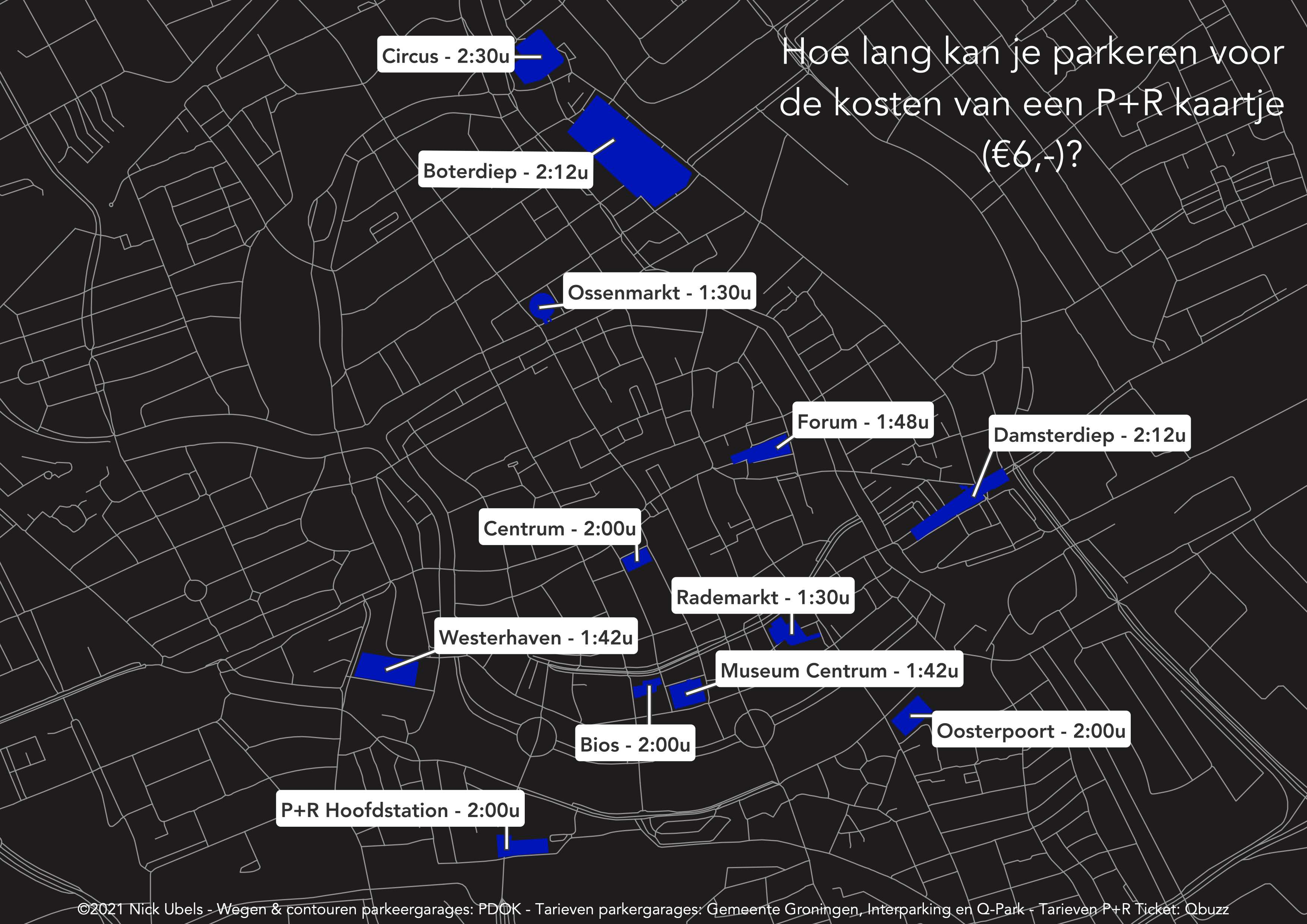
Parking/bus fare comparison
Personal IndividualAnalysis of the time one could park in an underground parking garage in Groningen for the cost of a P+R bus ticket.
LinkedIn post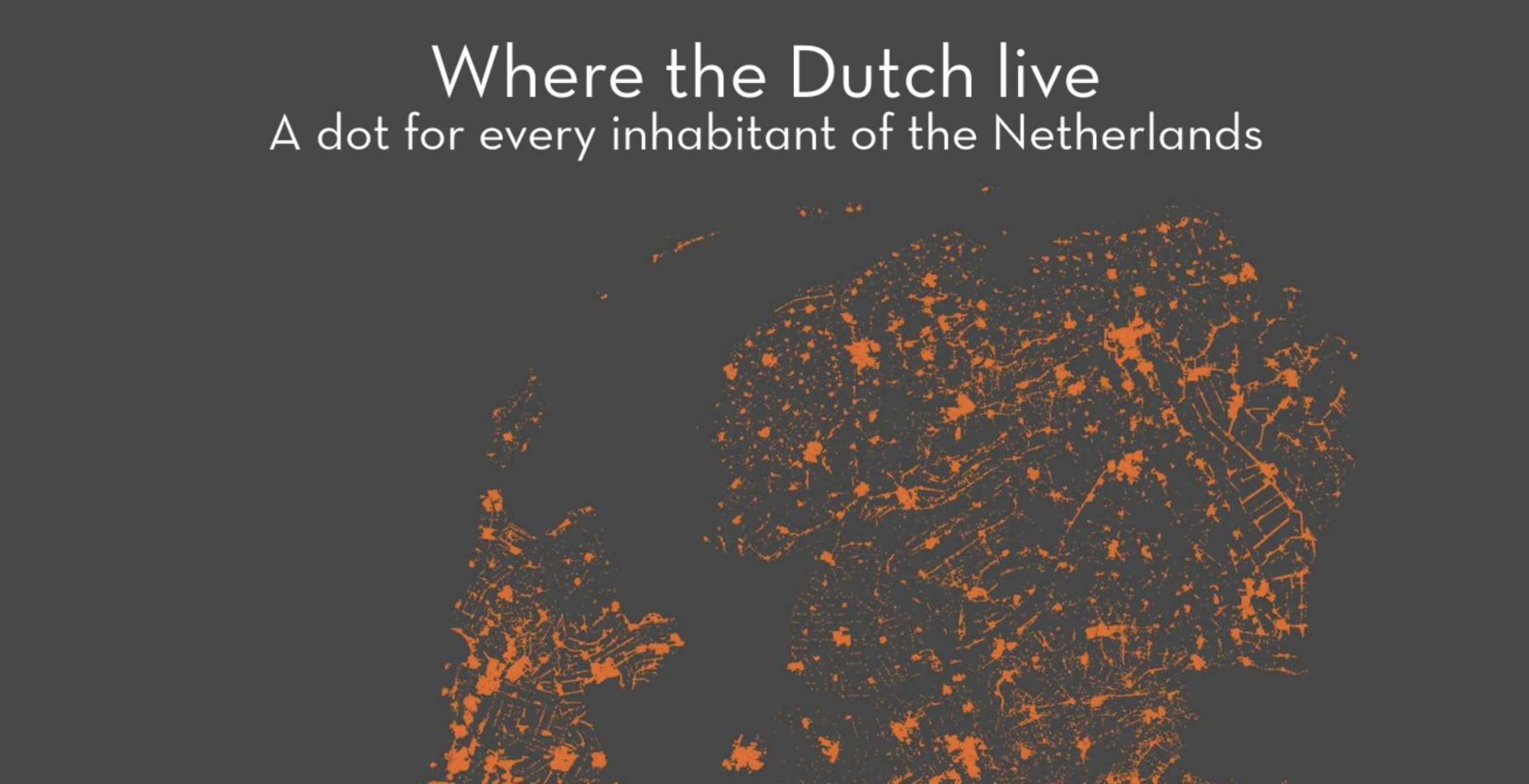
Viral maps
Work Individual workProduction of serval viral maps for the social channels of Geodienst. Ranging from population to transit profitability.
Map 1 Map 2 Map 3 Map 4
Bachelor's thesis
Bachelor Individual workClassification project on hyperspectral data with two convolutional neural networks. Goal was to detect asbestos roofs based on aerial hyperspectral imagery.
Download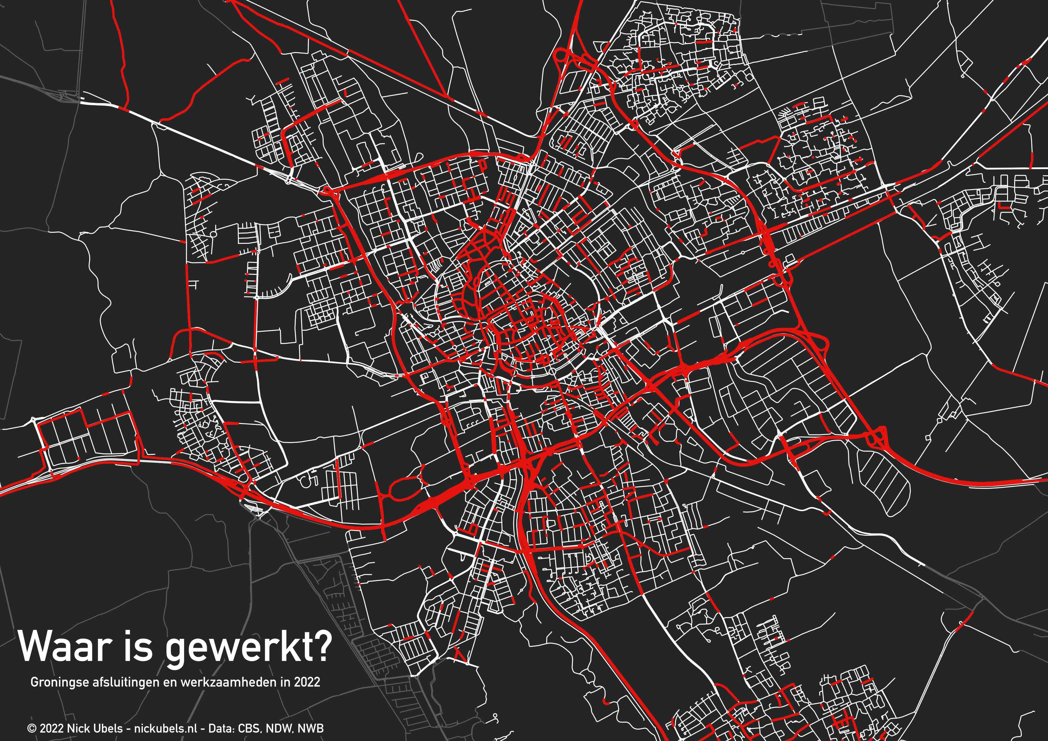
Roadwork and road closure visualisation
Personal IndividualVisualisation of all 2022 road works and closures in the city of Groningen based on NDW open data.
LinkedIn post Reddit post Article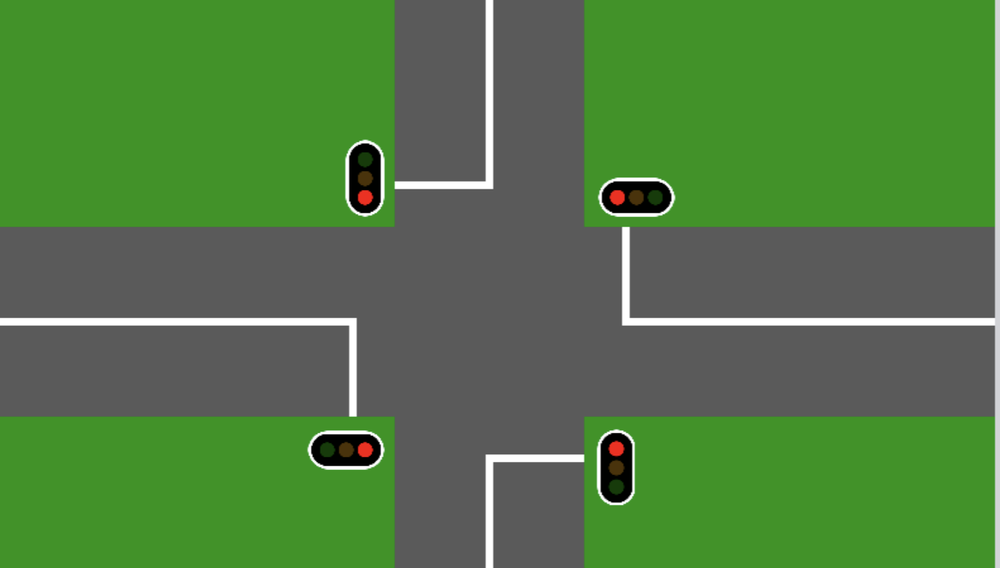
Signal priority simulation
Bachelor Group workMulti-agent systems project comparing two wireless protocols in a traffic light priority context.
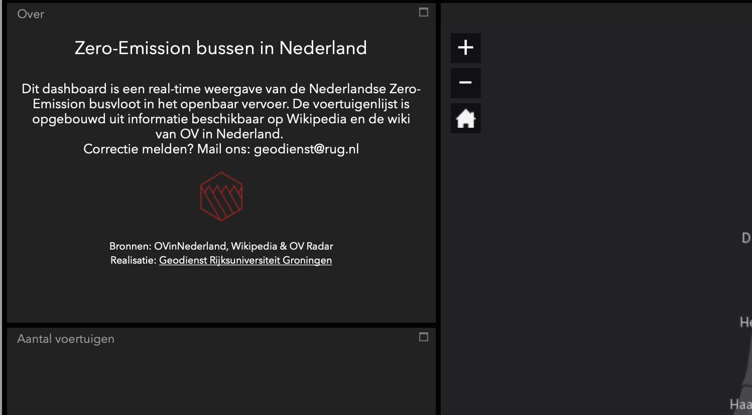
ZE-bus visualisation (deprecated)
Work Individual workA small ArcGIS Online visualisation showing the realtime position of all zero-emission buses in The Netherlands together with an overview of model and make.
Interview 1 Interview 2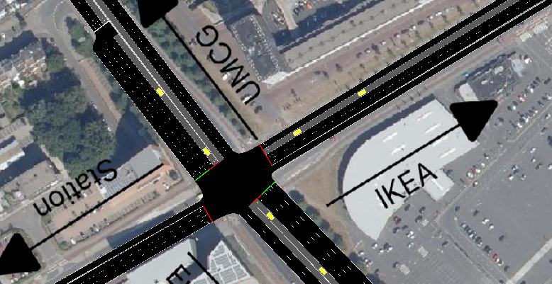
Intersection simulation
Master Group workMulti-agent systems project investigating the effects of transit signal priority on green light optimal speed advisories for a simulated intersection.
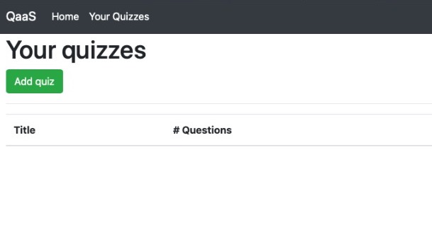
Quiz as a Service
Master Group workInteractive Quiz as a Service platform built with microservices and containers.
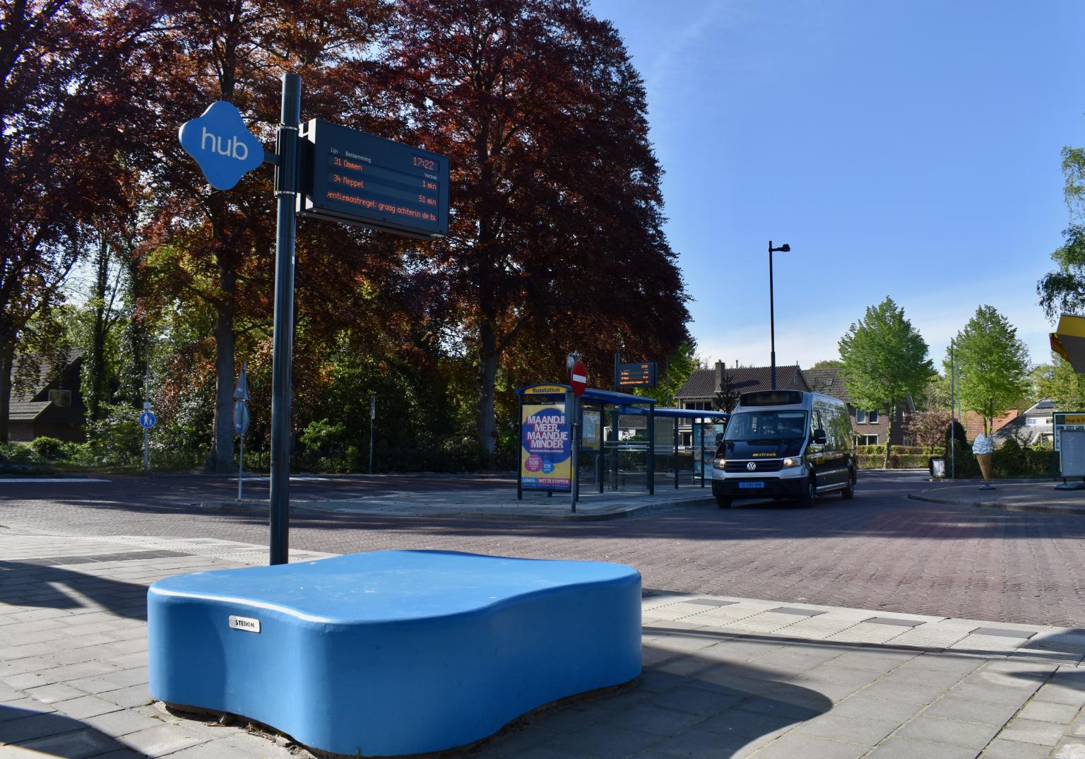
Real-time transit information displays
Work Group workPlanning and inspection of 60+ new real-time transit information displays on different mobility hubs.
Languages
Soft skills
Programming, presenting, analysis, collaboration, understanding complex domains, proactive, strategic, passioned, connecting data and reality, thinking critically, advising
Programming languages
Python, Matlab, Java, C, R, TeX, HTML, CSS, PHP, JavaScript, Swift
Packages
PyTorch, Pandas, Numpy, Scikit-Learn, Matplotlib, Leaflet
Tools
Git(Hub), Docker, Kubernetes, QGIS, PostGIS